| Captain Siborne | 09 May 2025 1:46 a.m. PST |
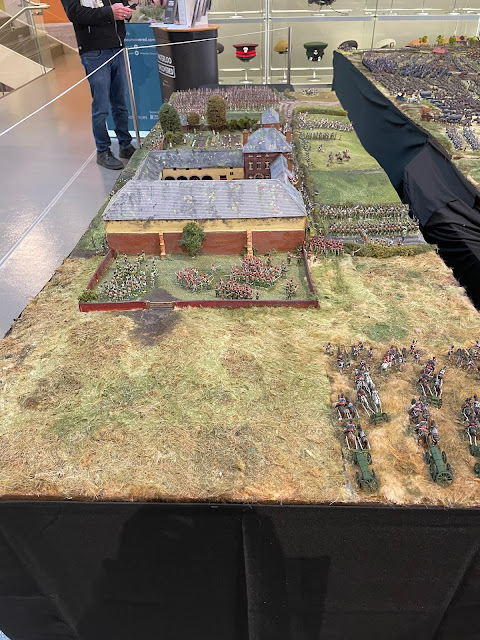
Dear All, I'm looking for advice about the hamlet of Smohain. Now that I've completed the farms of Papelotte, La Haye and Frischermont, I need to join these up. The intervening real estate is covered by the small village of Smohain known nowadays more often as La Marache. Here are some pictures of the completed farms: La Haye Farm:
Papelotte:
Frischermont:
This image shows the farms and village in relation to each other:
This shows the modern village:
This shows the Siborne Anaglyptographic map (yes that is a word:
This a later 19th Century map:
This is probably the best source, taken from the cadastral map:
None of the above maps indicate a church in Smohain and yet this image shows one:
As does this:
This image from the Rouse and Mudford series of prints is entitled "Frischermont" but is obviously meant to show a village not the chateau:
It also shows a church. It is highly unlikely that a ruined church would not have been rebuilt after the battle. Since churches are always shown on maps (for instance the equivalent cadastral map of Plancenoit clearly shows the church) and since no map shows a church in Smohain, I am drawn to the conclusion that there was no church. Instead, I suspect that the artists had painted the church not in Smohain, but in Ohain which is much further East. This image of the Ohain church ties in with the images:
Finally, this quadrant of a Waterloo panoramic clearly marks Papelotte, Frischermont and the church at Ohain:
My mission now is to make a diagram of the houses that existed in 1815. In this regard, I've been helped by Chris Dodson who has sent me some black and white aerial images. My questions to the collective brain of forum members are twofold: does my logic sound about right? do you have any other source material? many thanks! |
| CHRIS DODSON | 09 May 2025 2:58 a.m. PST |
Great researching and realisations Captain. Looking forward to your father's craftsmanship for Smohain. Best wishes, Chris |
BillyNM  | 09 May 2025 3:52 a.m. PST |
I assume you have the Craan and Ferraris maps, but you don't list them – is there a reason? |
| Captain Siborne | 09 May 2025 4:21 a.m. PST |
Thanks Billy, I do have them and neither shows a church. They are very useful for the position of the cottages. |
| BillyNM | 09 May 2025 9:35 a.m. PST |
Are you sure the building with a spire is a church? Neither of the images show a stone tower like that in the modern photo. The narrow pointy type of spires were sometimes seen on other buildings, albeit usually more important structures, as conductors. The Ferraris map does show one building that is more or less at right angles to most in village (hamlet?) as is the building in your images. Of course if it were a church it would likely be aligned to face east as is that on the Ferraris map. |
| Captain Siborne | 09 May 2025 1:55 p.m. PST |
Thanks Billy, my deduction is that if it's in Smohain it's not a church but it's more likely to be the church in Ohain. What is interesting is that if this is Ohain, then fighting took place a lot further east than previously thought, |
| 79thPA | 10 May 2025 6:05 a.m. PST |
I can't help, but that's great work. |
| CHRIS DODSON | 10 May 2025 7:32 a.m. PST |
Just a thought but as Mr Billy suggests, is that Mudford painting featuring a church or just a bell tower type of structure? The churches around this region do seem to conform to a general style' as witnessed by the two paintings illustrated and today's edifices, although some are more elegant than others, ie Wagnelee and the rebuilt Plancenoit. The Weller aerial pictures from 1967 show no evidence of foundations or a structure other than the farm style buildings. As a comparison the Frischermont foundations are clearly visible in the pictures. Best wishes, Chris Chris |
| Captain Siborne | 10 May 2025 11:14 a.m. PST |
|
 deadhead deadhead | 15 May 2025 1:07 p.m. PST |
That tower is very slender for a local Belgian church. Could it just be a school belltower? There is still a building that looks vaguely like an old schoolhouse
|
| Allan F Mountford | 20 May 2025 7:56 a.m. PST |
The cadastral map at pic 9 is from the 1850's, I believe. I have an earlier map based dated 1830 incorporating changes up to 1843. There is no building on the land plots designated 161.
Kind regards
Allan |
| Prince of Essling | 20 May 2025 9:44 a.m. PST |
Allan, Interesting Craan's map (1816-17)which predates the 1830 Cadastral Survey & Siborne's map shows a building in that spot. I can only surmise that the original building was demolished sometime after 1821 & then a new one built in its place before 1850. Am still going through all of my 1815 material to see if I can throw any useful information on Smohain/La Marache. Ian |
| deadhead | 20 May 2025 1:30 p.m. PST |
Oh yes please. Anything would help, I just know that James and his father would say. I have used much guesswork , Craan's map from 1816 and a modern Google Earth tour to try to reach soem conclusions. |
| Allan F Mountford | 21 May 2025 2:10 a.m. PST |
Ian
I would naturally agree that Craan is the starting point for any analysis. Frustrating that we can plot the appearance and disappearance of buildings but still cannot settle on what our eye witness artists actually saw!
;-)
Kind regards
Allan |
| Captain Siborne | 21 May 2025 3:24 a.m. PST |
Sorry to have dropped off this discussion, I've been away in foreign parts. Very many thanks for your continued research – it's amazing what this forum can achieve! |
| Prince of Essling | 26 May 2025 1:46 p.m. PST |
@Captain Siborne, Sorry it has taken me longer that I had anticiptaed to respond. It is clear that some images were attributed to incorrect geographic locations, whereas in fact they were of another place. I definitely agree with your conclusion about the church with the large rectangular tower being in Ohain having seen a couple of black & white photos circa 1890s/early 1900s. Copy at link Below from Waterloo Blogger's website
Smohain is on the left, the brook can be seen above the hamlet
Papelotte (centre) with La Haye on its right. On the far right is the hamlet of Smohain.
Andrew Uffindell & Michael Corum " On the Fields of Glory the battlefields of the 1815 Campaign" page 230 says: "Smohain is today, called La Marache and although modern houses have replaced old ones, the hamlet has not increased much in size. La haye farm, 400 metres to the West, was destroyed by fire around 1910. It was rebuilt with brick walls and tile roofs and looks much easier to defend today than it was in 1815. During the battle, the farm buildings were only one story high and the walls made from cob, a composition of clay, gravel and straw. The roofs were made of thatch. Papelotte farm, 100 metres west of La Haye, was rebuilt after being devastated by fire during the battle. In 1860 a belvedere was added over the main gateway." I have extracted the section from the Craan map & attempted to plot approximately the Craan buildings against the modern google map. Craan extract at link Google map at link Unfortunately I have been unable to trackdown any contemporary images for Smohain only the one you have already seen an wrongly attributed as Frischermont! Have also looked at various historical atlases as well oldmaps online at oldmapsonline.org/en but nothing better than Craan for near contemporary detail. Ian |
| CHRIS DODSON | 27 May 2025 11:59 a.m. PST |
Mr Jac Weller took those pictures in the 1960's and they are in his book, Wellington at Waterloo. Chris |
| Prince of Essling | 27 May 2025 12:43 p.m. PST |
The Waterloo Association says "Smohain had half its houses gutted while La Haye and Papelotte had also been severely damaged." I forget to say in my earlier post that none of the maps etc that I consulted appeared to show a church/chapel in Smohain. |