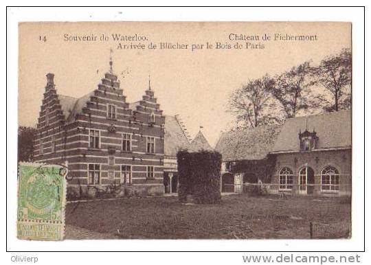
| Captain Siborne | 04 Sep 2024 12:55 a.m. PST |
I am attempting to piece together the evidence about the Chateau of Frischermont at Waterloo. Frischermont was at the east end of the battlefield, initially defended by the 28th Orange-Nassau regiment; it then fell to the French and was later taken by the Prussians. Because it is not on the Siborne model and was destroyed in the 60s, the evidence is circumstantial. Any advice additional to what I have below would be massively appreciated.
This image shows the area after the demolition of the chateau. All that remains is the wall of the walled garden and a round well just to its right:
As said earlier, any further leads or suggestions would be much appreciated! |
| Prince of Essling | 04 Sep 2024 1:17 a.m. PST |
Nice work refer to "Frischermont Buildings" Topic at TMP link From my post under the picture of the village: "The text in Coppens' work says approx:
In 1815 the chateau had a feudal look, with a massive tower and buildings forming an irregular rectangle. The tower was square surmounted with a four-sided peaked roof. The upper part of the tower was decorated on each face by a medallion bust and a round turret at the four corners. No windows could be seen, only narrow loopholes. The main building and the tower dominated the steep-sided path that goes down to La Marache." Clearly more needs to be done to determine the exact look. General view towards Frischermont in 1816 (last image immediately before page 89 which supports the tower, though admittedly from afar) from "Sketches In Flanders And Holland; With Some Account Of A Tour Through Parts Of Those Countries, Shortly After The Battle Of Waterloo; In A Series Of Letters To A Friend: By Robert Hills"
link |
| Prince of Essling | 04 Sep 2024 5:17 a.m. PST |
Extract from Craan map showing Frischermont area etc at link |
 deadhead deadhead  | 04 Sep 2024 9:19 a.m. PST |
Robert Hills' book is a fantastic find. The text is fascinating and the sketches/plates I, for one, have never seen reproduced before. I have downloaded it to read cover to cover. Really grateful |
| Prince of Essling | 04 Sep 2024 1:32 p.m. PST |
Extract from Coppens with full text about Frischermont at link |
| Captain Siborne | 04 Sep 2024 1:58 p.m. PST |
Many thanks to everybody for these fantastic leads, which are all very helpful, notably the Robert Hills letters and sketches which are extremely well observed. |
| Delort | 05 Sep 2024 5:36 a.m. PST |
I thought Frischermont was excavated by Waterloo Uncovered two or three years ago: did they come up with anything? |
| Captain Siborne | 05 Sep 2024 7:26 a.m. PST |
They found an underground lavatory! I've asked if they have anything else but nothing so far. |
| Prince of Essling | 05 Sep 2024 9:36 a.m. PST |
For a brief 2022 report see link "Searching for Châteaux Frischermont
On the far side of the battlefield, hidden amid dense woodland, is the site of the vanished Châteaux Frischermont. Occupied by the 28th Orange-Nassau Regiment, this farm guarded the extreme left flank of the Anglo-Dutch battle-line. Three days prior to Waterloo, these Dutch troops had bought time for the Allied armies to concentrate by making a stand at the village of Quatre Bras. Originally of similar size to Hougoumont, Frischermont farm was demolished in the 1960s following a catastrophic fire. With the buildings gone and the site accessible only by a dirt road, the role this position played in the battle had been largely forgotten. It was near this location that arguably the first shots of the battle were fired, when French cavalry patrols encountered Dutch pickets. Later in the afternoon, Frischermont became the first part of the Anglo-Dutch line to be relieved by the arriving Prussians. This makes the farm particularly significant for Dutch VSMPs, who regularly make up nearly a fifth of all participants on the project. The archaeology at Frischermont is still in its early stages, but the fact the buildings were demolished means that the site is ideal for excavation. Already, an underground vaulted cellar or latrine has been identified, as well as the external wall of one of the farm's barns. The excavation of these features provides useful details for the reconstruction of what the farm may have looked like at the time of the battle. It is hoped that further archaeological survey of the site will throw more light on the fighting on the Anglo-Dutch left flank and the arrival, in the nick of time, of Blücher's Prussians." |
| Captain Siborne | 05 Sep 2024 1:57 p.m. PST |
|
| Allan F Mountford | 06 Sep 2024 10:16 a.m. PST |
I posted this under 'Mystery buildings', but is this a view of Frischermont sketched in 1815?
Kind regards
Allan uurl.kbr.be/1914577 |
| Prince of Essling | 06 Sep 2024 1:51 p.m. PST |
Here are two other images of Frischermont: 1st: Clearly after the Lion Mound construction but before 1835
2nd: says about 1835
|
| Prince of Essling | 06 Sep 2024 3:34 p.m. PST |
The Waterloo Uncovered Impact Report for 2019 (page 29) has an image of a clay model of part of the chateau…
PDF link |
| Captain Siborne | 07 Sep 2024 9:52 a.m. PST |
Dear Essling, I must say that that last image has thrown me – the mansion on the left (West side) looks similar but different to the photo of the Neo-Gothic later building and seems very far to the left. The gate that was in the foreground is also missing. As with the addition of the Lion's Mound (which is impossible to see from there) do you think it is representative rather than exact? |
| hannover | 07 Sep 2024 1:36 p.m. PST |
What is known of the fight for Frichermont is given in Paul Dawson's book 'Waterloo Casualties' pages 122 to 126.The building comprised of a chateau and a farm forming an irregular rectangle of about 80 x 50 metres around a large courtyard. In the southwest corner was a huge barn. The complex was dominated by a massive square tower containing only narrow lancer-type windows. This tower was situated in the northeast corner of the complex.
A member of 28th Orange Nassau Regiment that defended the complex states that it was surrounded by a wall 3 to 4 foot high. They defended against voltigeurs, presumably members of 13th Legere forming the skirmish line of Durette's 4th division. Members of 28th Orange Nassau mention two reasons why they were unable to hold Frichermont and were forced to withdraw midafternoon – first, they were running low on ammunition and were unable to use the same cartridges as 2nd Nassau regiment as they used French muskets and second the approach of around 4,000 men – presumably Durette's second assault of the day. |
| Prince of Essling | 07 Sep 2024 2:13 p.m. PST |
Captain Siborne, Good question. The lithograph forms part of a set of 12 (by an anonymous artist) from 1835, but which publication they form part of is not indicated:
Prussian memorial – Battle of Waterloo – Iron Cross (Belgium)
Ferme du Caillou – Genappe – Napoleon's Last HQ (Belgium)
Castle and farm of Frischermont – Lasne – Walloon Brabant (Belgium)
Farm – Papelotte – Waterloo battlefield – Walloon Brabant (Belgium)
Farm – Belle Alliance – Waterloo battlefield – Walloon Brabant (Belgium)
La Haye Sainte farm – Walloon Brabant (Belgium)
Hougoumont castle and farm – Braine-l'Alleud – Walloon Brabant (Belgium)
Farm house of Mont St. Jean – Waterloo (Belgium)
General view of the Waterloo battlefield – 1815 (Belgium)
Lion's Mound – Memorial to the Battle of Waterloo – 1815 (Belgium)
Lion's Mound – Memorial to the Battle of Waterloo – 1815 (Belgium)
Church of Waterloo – Walloon Brabant (Belgium) They can all be viewed at link |
| Captain Siborne | 08 Sep 2024 2:42 a.m. PST |
Dear Hannover and Essling, very many thanks for all this useful material. You and others prove the value of this forum! Hannover, I remain convinced that the tower was at the southeast corner and not as Coppens says at the north east – the track junction in front of the tower can only make sense if it is such. The set of 12 Lithographs is interesting in so far as it is dated 1835 but shows the tower at Papelotte which I had always thought was built a bit later. The location of the Neo-Gothic mansion at Frischermont is interesting but actually not relevant – wherever it was built, it wasn't there in 1815. I have however emailed the two leading archaelogists at Waterloo Uncovered but haven't had an answer – if they do have a ground plan it would be useful. |
| Druzhina | 08 Sep 2024 2:44 a.m. PST |
|
| Prince of Essling | 08 Sep 2024 3:18 a.m. PST |
Cpatain Siborne, I would have to agree with your conclusion about the position of the tower. Am still looking for other prints of Frischermont. Unfortunately Craan's work doesn't include a print of Frischermont. There is a panoramic drawing by De Bas (but I am not sure it goes far enough to the left of the Anglo-Allied position as the copies I have seen so far seen are not good quality). hopefully the archaeologists will respond positively.
All the best
Ian |
| hannover | 08 Sep 2024 4:04 a.m. PST |
I wondered when I read Dawson's account whether the layout of the tower and barn was indeed correct. Dawson references the layout as personal correspondence with historian Pierre de Witt.
Levens miniatures have a model of Frichermont pictures of which are available here: "https://perfectsixps.proboards.com/thread/329/frichermont-ch-teau-leven-miniatures" Whether they obtained a ground plan for their model I do not know but it may be worth contacting them. |
| Allan F Mountford | 08 Sep 2024 7:07 a.m. PST |
Per the Jones sketch in 1815 and the watercolour version by Turner in 1816:
|
| deadhead | 08 Sep 2024 10:55 a.m. PST |
It is amazing how folk keep coming up with new artwork that I, for one, have never seen before. I think there is a common confusion, or was then, between the Hamlet of Frischermont and the Chateau of. That hamlet we generally call Smohain, but is it not now known as La Marache? This is a well known image that comes up immediately on Wiki telling us it is the "Castle of Frischermont", which it surely ain't;
|
| Captain Siborne | 08 Sep 2024 11:23 a.m. PST |
Many thanks again for everybody's help. Allan, I've never seen your first image of the church at Smohain before, which ties in nicely with the image of 'Frischermont' which Liam rightly points out is really the hamlet of Smohain/La Marache. |
| Allan F Mountford | 09 Sep 2024 4:00 a.m. PST |
@Captain Siborne
Have we established where the church at Smohain was? I cannot see it on Google Earth, and Siborne does not show a church steeple at Smohain (unless I have missed it).
Kind regards
Allan |
| Allan F Mountford | 09 Sep 2024 7:12 a.m. PST |
Apparently, in 1827 you could view Frischermont from the Lion Mound:
link
Visible at 0300 on the image.
Kind regards
Allan |
| Prince of Essling | 09 Sep 2024 8:46 a.m. PST |
View of the battlefield from the Allied position – spire can be seen (at number 6) [Gezicht over de vlakten van Waterloo waar op 18 juni 1815 de veldslag plaatsvond. Rechts de Leeuw van Waterloo, het monument voor de slag opgericht 1823-1826. Met links en rechts de legenda 1-29 in het Engels]
link |
| Allan F Mountford | 09 Sep 2024 9:05 a.m. PST |
Another view to the east from behind La Haye Sainte. Is this the church at Smohain?
Detail:
|
| Allan F Mountford | 11 Sep 2024 7:17 a.m. PST |
From the cadastral map of 1840:
|
| deadhead | 12 Sep 2024 1:08 a.m. PST |
Oh good. The response box is restored. Thanks to the Editorial Staff for fixing that for me. Thanks to great detective work by all I think we can see two rhomboid spires to the east. A very modest narrow one with a cross atop and a much chunkier, lower, one quite like the original chateau tower. There is increasing evidence, it seems, for a chapel in Smohain, now long gone, ot at least decommissioned. Finally that last map above. There is a structure labelled 35 entirely separate from the main complex. We see it in Prince of Essling's framed print above (1835). It looks like nothing we have seen before, nothing like the Gothic horror and differently placed, so it must have been fictional. At least until we see that map. Looks like they had money to splash out at Frischermont for rebuilding! Quite irrelevant to 1815, but fascinating nonetheless, and sure to confuse the diggers of Waterloo Uncovered…….? |
| Captain Siborne | 12 Sep 2024 8:29 a.m. PST |
That cadastral map is hugely helpful. The building at 35 feels to me like it's a housekeeper's or gardener's cottage. |
| Captain Siborne | 12 Sep 2024 8:36 a.m. PST |
Allan, you wouldn't have the broader view of Smohain and La Haye too? |
| Allan F Mountford | 12 Sep 2024 1:51 p.m. PST |
I will revisit tomorrow – cadastral maps are a bit of a challenge!
Kind regards
Allan |
| Allan F Mountford | 13 Sep 2024 2:40 a.m. PST |
Extract showing Smohain (La Marache) and La Haye. I have re-orientated the map so that north is to the top of the screen.
Link: uurl.kbr.be/1038025 |
| Captain Siborne | 13 Sep 2024 11:53 p.m. PST |
Thank you Allan, really useful. I found this site which allows you to compare the same location on different historic maps. |
| Captain Siborne | 13 Sep 2024 11:54 p.m. PST |
|
| Allan F Mountford | 14 Sep 2024 4:47 a.m. PST |
Excellent site. The best way of navigating the Ferraris map collection. This site does something similar: link |
| CHRIS DODSON | 14 Sep 2024 8:17 a.m. PST |
Excellent research from all. Best wishes, Chris |
| Prince of Essling | 15 Sep 2024 3:49 p.m. PST |
Having looked at various historical maps [in particular, the maps of Fricx (1712), Ferraris (1771-78), Vandermaelen (1846-54) and Popp (1842-79), the Atlas der Buurtwegen (1841)] the only church would appear to be south east of Frischermont (Ferraris) none showing in Smohain.
link |
| Captain Siborne | 16 Sep 2024 3:33 a.m. PST |
Thanks Essling, I wonder whether that is a church or a chapel? There is a smilier symbol in the wood south of Hougoumont and we know that Waterloo Uncovered have been doing some archaeology at that chapel location. |
| Prince of Essling | 16 Sep 2024 4:17 a.m. PST |
@Captain Siborne, Good point – probably a chapel as it was so close to the chateau. |