Ponder  | 23 Sep 2015 7:28 a.m. PST |
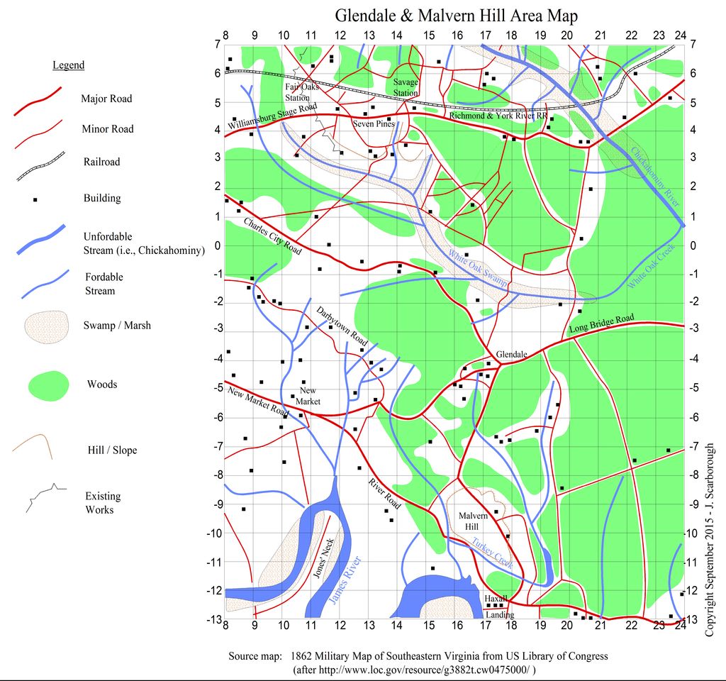
Howdy, This draft map shows the area south of the "Gates of Richmond Map." It can be used for Peninsula actions following Gaines Mill. It will be included in "A Storm in the Valley 1862" the forthcoming ACW scenario book for Volley & Bayonet. One grid square is one foot on the table top, 1200 yards. The coordinates shown correspond to the "Gates of Richmond Map."
Ponder on,
JAS
|
| general btsherman | 23 Sep 2015 9:03 a.m. PST |
|
| Ponder | 23 Sep 2015 9:52 a.m. PST |
Howdy, Thank you, one of my goals it to give gamers an alternative way of viewing the battles – a more operational view. I think you can boil down the lessons of the peninsula in three bullets: (1) Converging columns don't. (2) Frontal assaults are costly. (3) Higher commanders need to be present to promptly react to changing circumstances. Ponder on,
JAS
|
| KTravlos | 23 Sep 2015 10:58 a.m. PST |
|
 McLaddie McLaddie | 23 Sep 2015 9:18 p.m. PST |
Nice. You got rid of the red-dotted major roads. Much cleaner and easier to read with all the black building squares. |
| Ponder | 24 Sep 2015 5:08 a.m. PST |
Howdy, Yes, I agree, but no more mile markers. The red dots were generally about a mile apart on the major roads. They did serve a purpose. JAS |
| vtsaogames | 26 Sep 2015 11:29 a.m. PST |
|
| Ponder | 12 Oct 2015 11:31 a.m. PST |
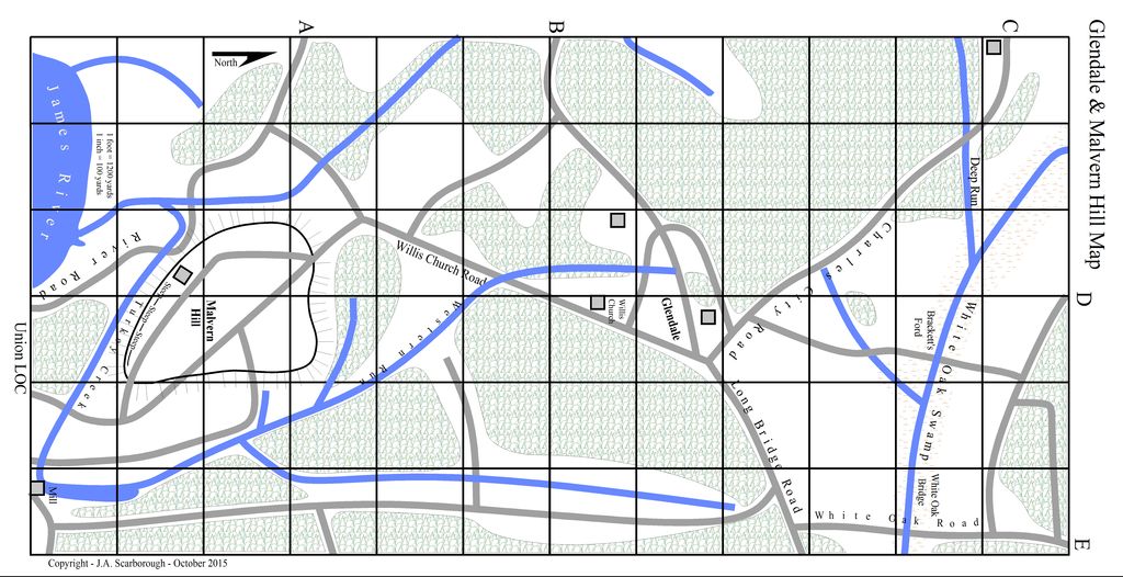
Howdy, Shown below is the draft, first cut, at the Scenario No. 9 map. Terrain derived from the area map shown above.
Ponder on,
JAS
|
| Darkoath | 16 Nov 2015 7:35 a.m. PST |
The only thing I would change for the Scenario 9 map above is making lettering for your labels right side up. So I would for example, turn Malvern Hill 90 degrees. And make sure the creek and road labels are right side up. Your maps look really good! When is this scenario book due out? |
| Ponder | 16 Nov 2015 8:15 a.m. PST |
Howdy, Imagine the "left side" is the bottom. Think about the dimensions of a page. I aim to finish the scenario writing by January, and get to layout by June 2016, with the goal of getting it out in Fall 2016. I note I have not coordinated this with Glenn at ToB; he might possibly prefer waiting to Historicon 2017. We'll see, but progress is being made. We just wrapped up the playtest of the Shenandoah Mini-Campaign. A Union victory. Ponder on,
JAS
|
| Darkoath | 17 Nov 2015 6:57 a.m. PST |
Oh sorry JAS that makes much more sense now… nice maps! |